Every diagram on OrbitalNodes is drawn here, from tracked orbital elements and published
regulatory filings rather than from stock artwork. They are released under
CC BY 4.0: use them in articles, lessons, papers or slides,
including commercially, as long as you credit OrbitalNodes.ai.
Each is offered as a raster image for convenience and as the original vector, which stays
sharp at any size and is the better choice for print.
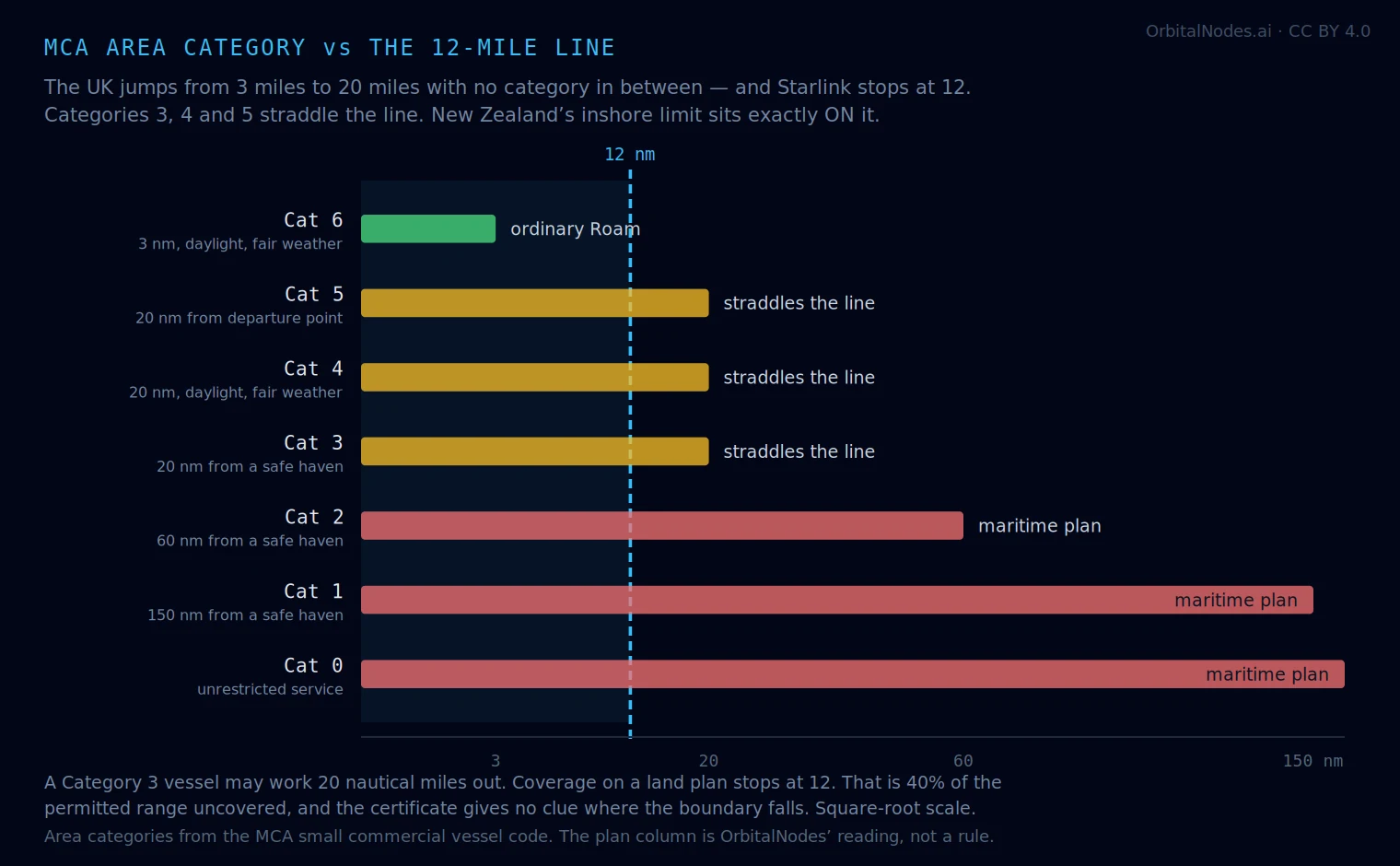
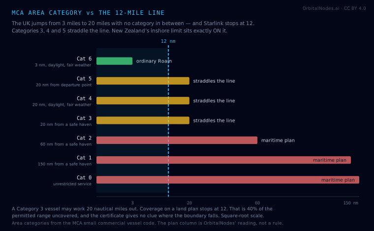
MCA area categories against the 12-mile lineThe UK jumps from 3 nautical miles to 20 with no category in between, so nothing lines up with where Starlink stops. New Zealand’s inshore fishing limit sits exactly on the same line.From Starlink for boats in the UK · vector version ·
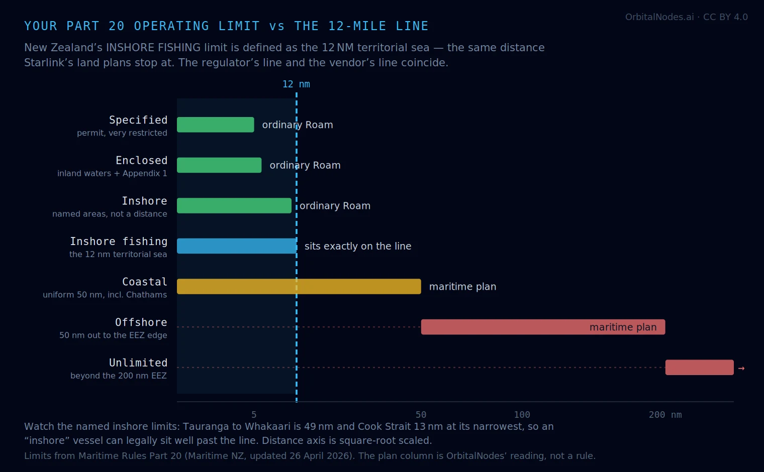
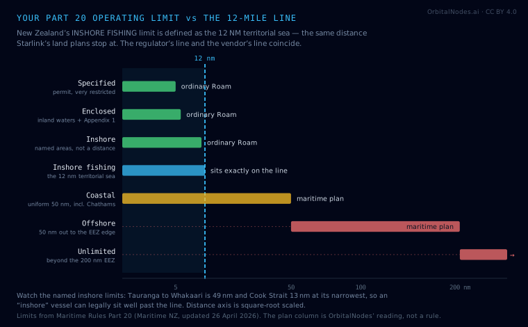
CC BY 4.0 — reuse it anywhere with credit to OrbitalNodes.aiMaritime NZ operating limits against the 12-mile lineNew Zealand’s inshore fishing limit is defined as the 12 NM territorial sea — the same distance Starlink’s land plans stop at, so the regulator’s line and the vendor’s coincide. Australia has no such luck: AMSA Category C runs to 30 NM and straddles the boundary.From Starlink for boats in New Zealand ·
vector version ·
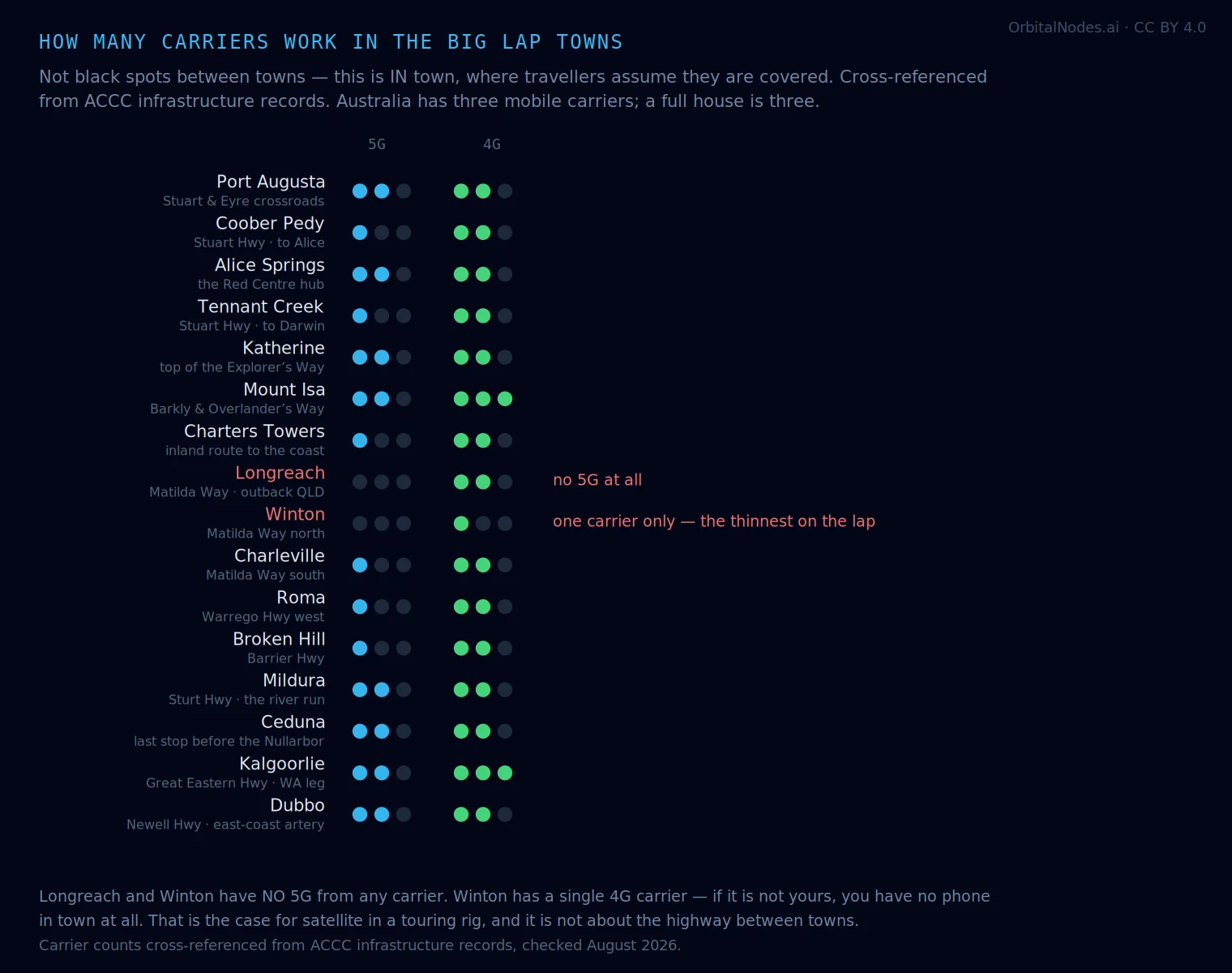
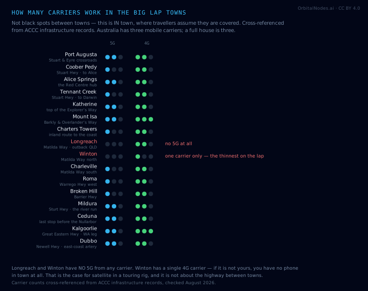
CC BY 4.0 — reuse it anywhere with credit to OrbitalNodes.aiHow many carriers work in the Big Lap townsNot the black spots between towns — this is IN town, where travellers assume they are covered. Longreach and Winton have no 5G from any carrier, and Winton has a single 4G carrier: if it is not yours, you have no phone in town at all. Cross-referenced from ACCC infrastructure records.From Starlink for caravans and RVs ·
vector version ·
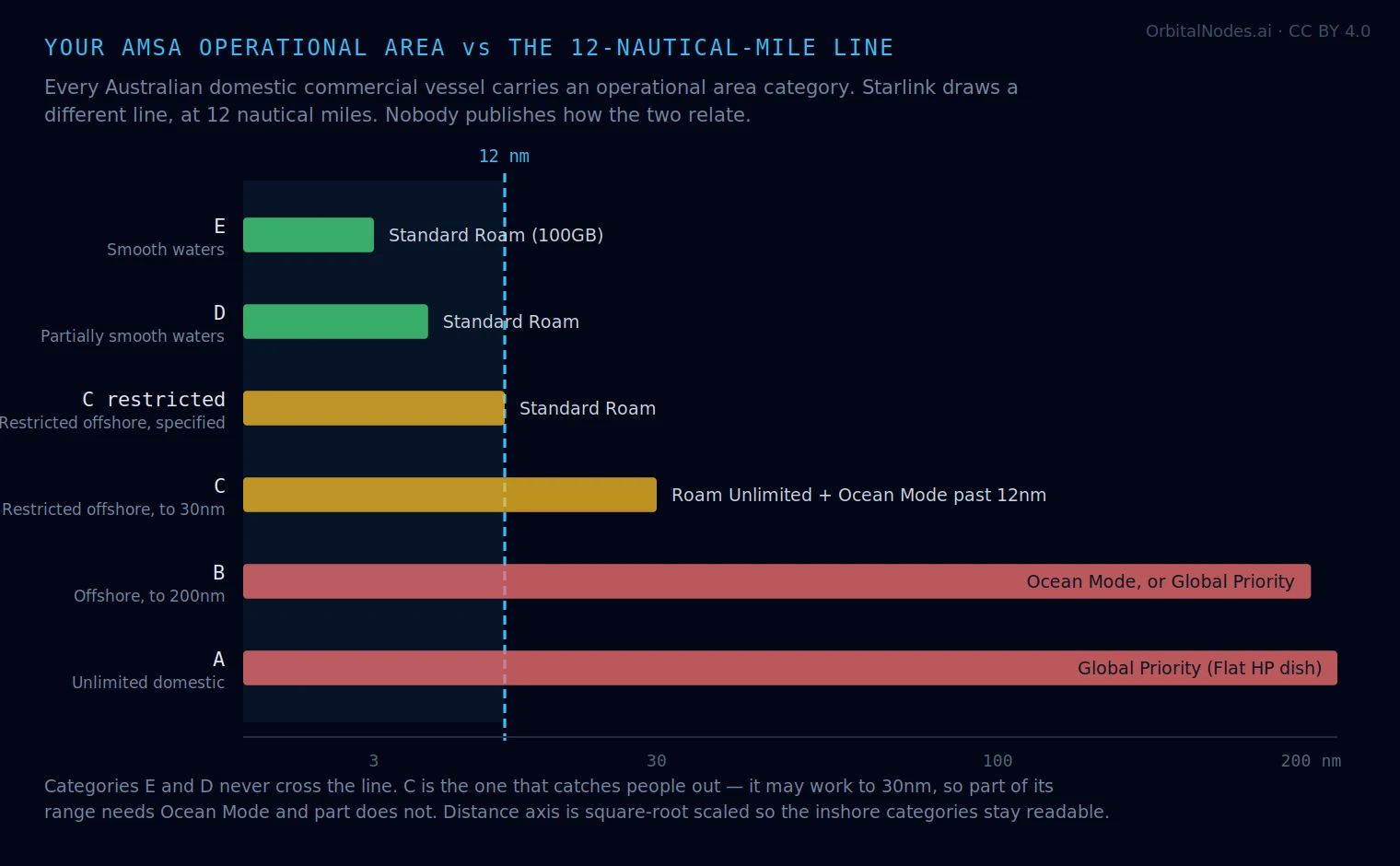
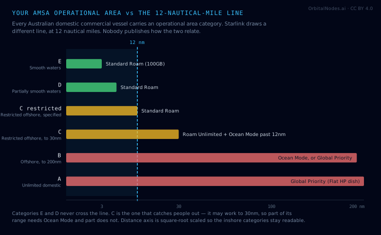
CC BY 4.0 — reuse it anywhere with credit to OrbitalNodes.aiYour AMSA operational area against the 12-nautical-mile lineEvery Australian domestic commercial vessel carries an AMSA operational area category on its certificate. Starlink draws a different line, at 12 nautical miles. Nobody publishes how the two relate. Category C is the one that catches people out — part of its range needs Ocean Mode and part does not. The plans named are for Australian waters; from 17 August 2026 the cheaper Roam tiers no longer work internationally at all.From Starlink for boats in Australia ·
vector version ·
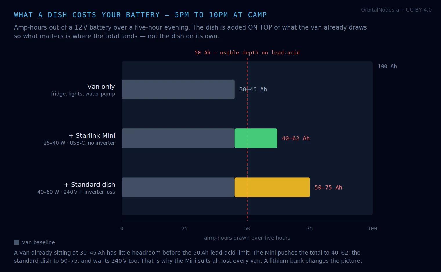
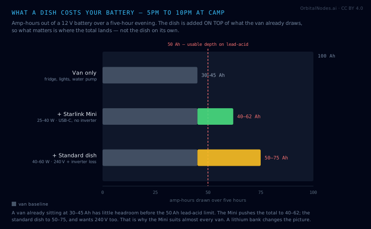
CC BY 4.0 — reuse it anywhere with credit to OrbitalNodes.aiWhat a dish costs your caravan batteryThe dish is added on top of what the van already draws, so what matters is where the total lands. A van already at 30–45 Ah has little headroom before the 50 Ah lead-acid limit — which is why the Mini, running natively from USB-C with no inverter loss, suits almost every van.From Starlink for caravans and RVs ·
vector version ·
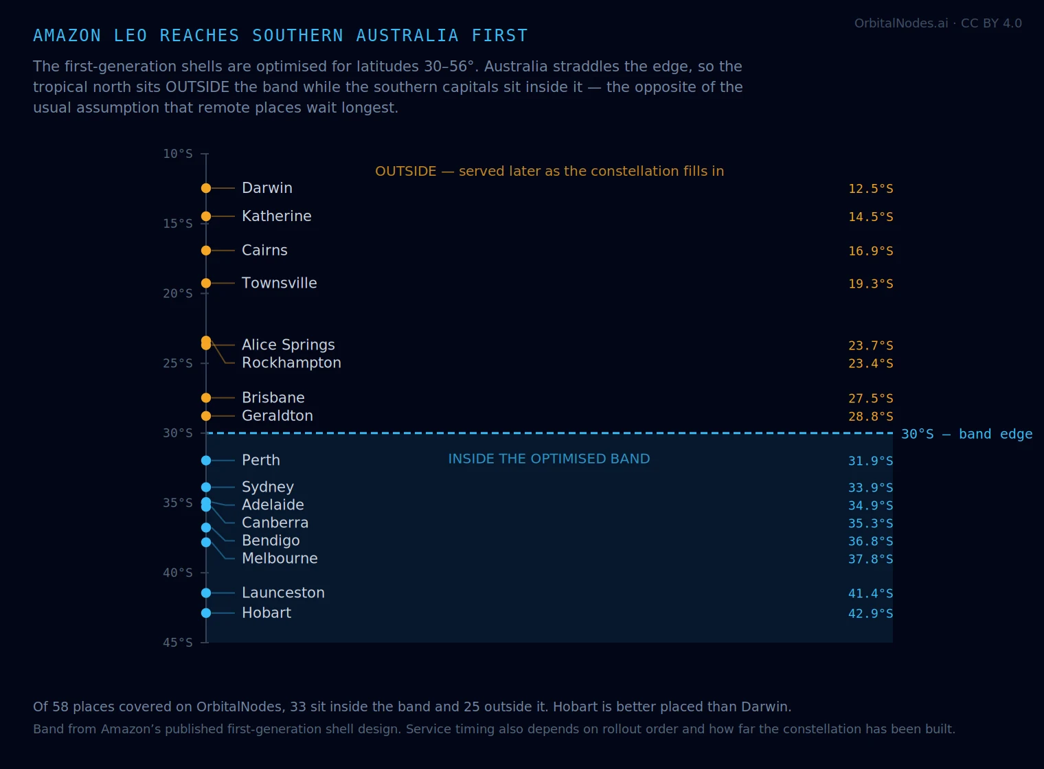
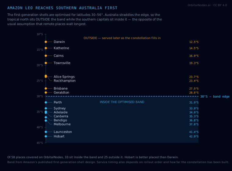
CC BY 4.0 — reuse it anywhere with credit to OrbitalNodes.aiAmazon Leo reaches southern Australia firstAmazon Leo’s first-generation shells are optimised for latitudes 30–56°, and Australia straddles that edge. Of the 58 places covered on OrbitalNodes, 33 sit inside the band and 25 outside — so Hobart is better placed than Darwin, which inverts the usual assumption that remote areas wait longest.From Satellite internet in Australia ·
vector version ·
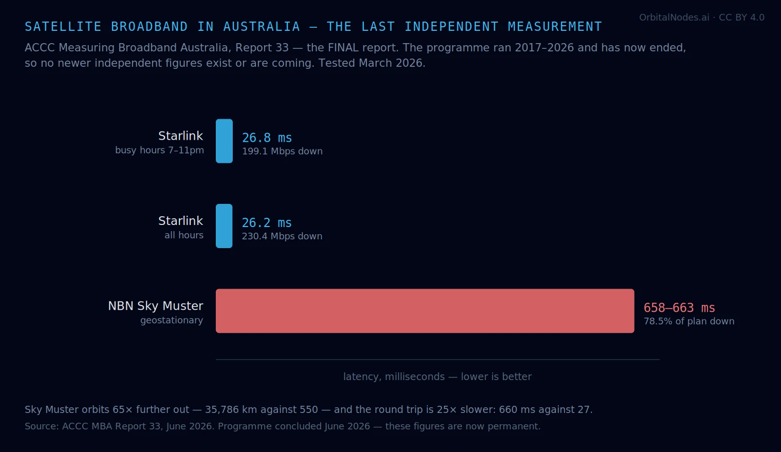
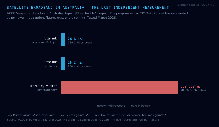
CC BY 4.0 — reuse it anywhere with credit to OrbitalNodes.aiSatellite broadband in Australia — the last independent measurementThe ACCC ran Measuring Broadband Australia from 2017 until June 2026, when the programme ended. Report 33 is therefore the last independent measurement of Australian satellite broadband there will be — every figure published after it is a provider claim or a self-selected sample.From Satellite internet in Australia ·
vector version ·
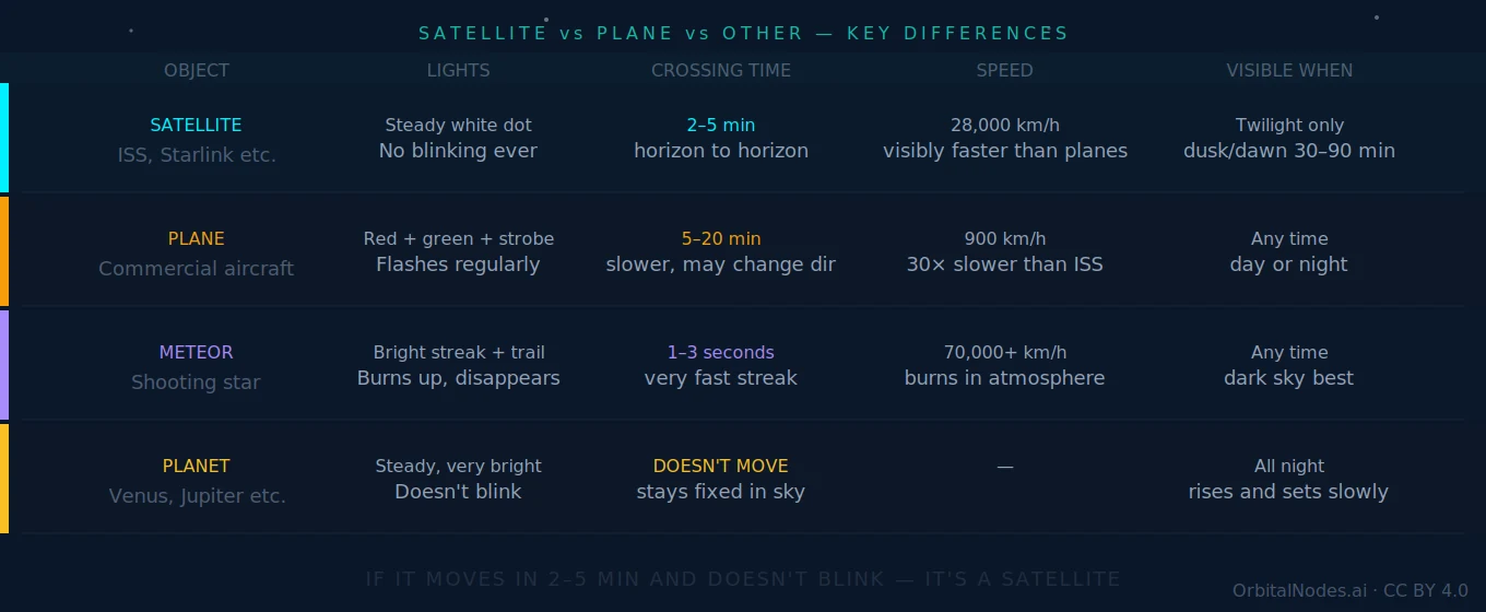
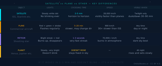
CC BY 4.0 — reuse it anywhere with credit to OrbitalNodes.aiSatellite, plane, meteor or planet — how to tell them apartThe four things people mistake for each other, by what you actually see. Crossing times and speeds are from tracked orbital elements; aircraft figures are typical cruise values.From Satellite or Plane? ·
vector version ·
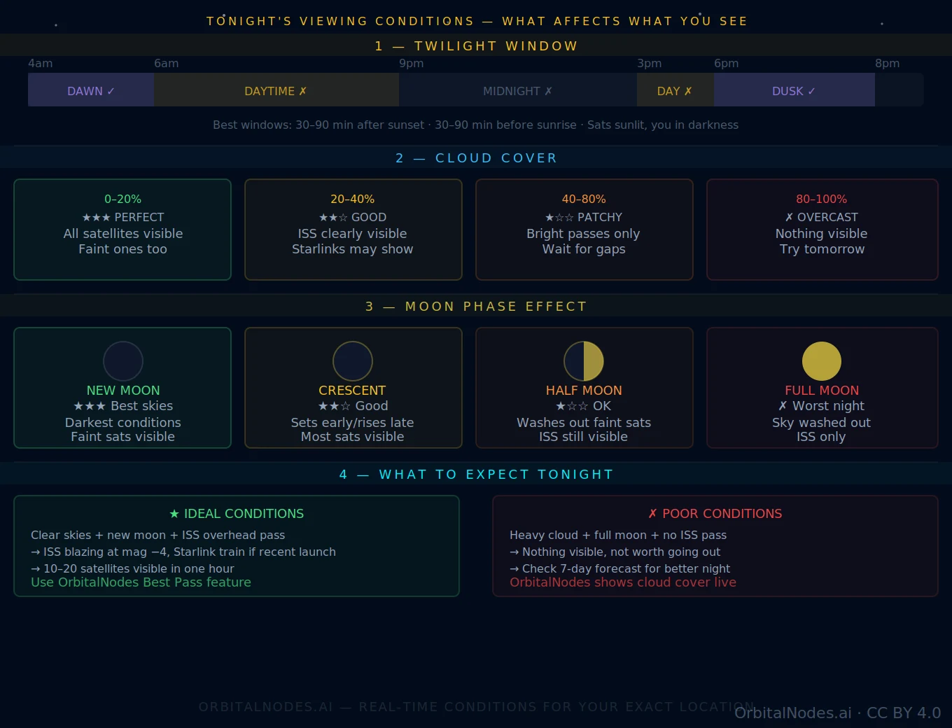
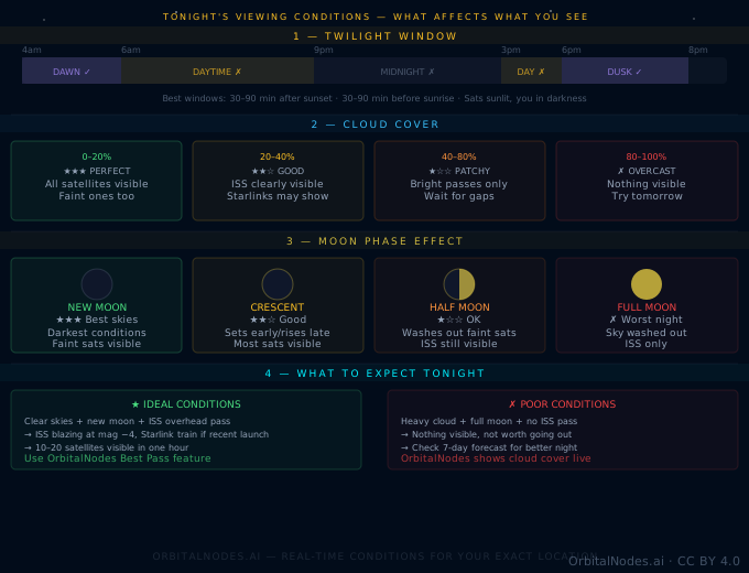
CC BY 4.0 — reuse it anywhere with credit to OrbitalNodes.aiWhat decides whether you see a satellite tonightThe model behind the nightly verdict: a satellite must be sunlit while your sky is dark, and cloud then decides whether any of it matters. Cloud bands and moon effects as applied by the site.From Satellites Tonight ·
vector version ·
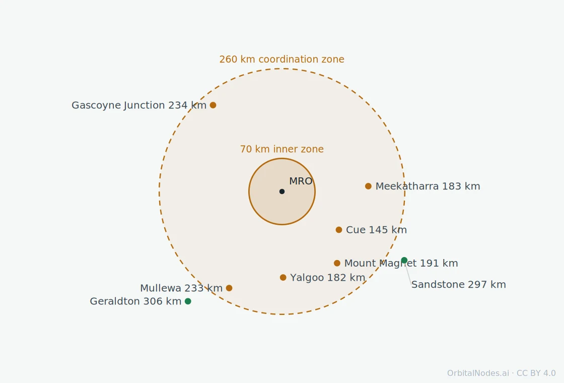
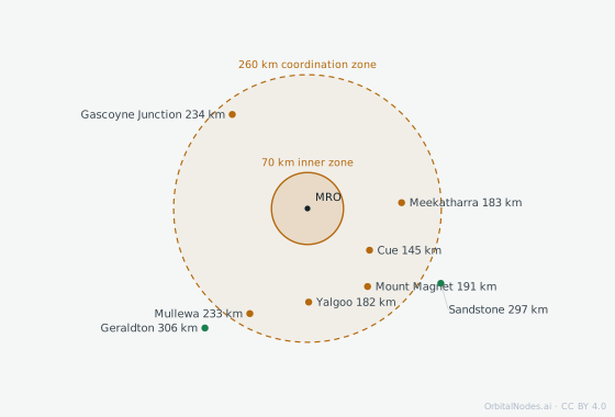
CC BY 4.0 — reuse it anywhere with credit to OrbitalNodes.aiThe Australian Radio Quiet Zone, and the towns inside itDrawn to scale. Distances and bearings computed from gazetted townsite coordinates (Composite Gazetteer of Australia, GDA94) to the zone centre at 26°42′15″S, 116°39′32″E. Zone radii from ACMA. Satellite texting is switched off inside it, and neither carrier publishes which towns are affected.From Satellite texting in Australia ·
vector version ·
CC BY 4.0 — reuse it anywhere with credit to OrbitalNodes.ai
Need one at a different size, or a diagram that is not here?
The vector files can be edited directly, or ask and we will draw it.